Grow more. Lose less. Sell better.
AgriSmartOne helps Ghana's smallholder farmers decide what to grow, how to grow it and how to sell it, as one field journey: drones and satellites scout every zone, local AI reads the land, and the harvest is sold to the best bid, paid by mobile money.
One farm, one season, six jobs done for the farmer
What the drones, the sensors and the app do between planting and payment. Pick a scene to see it in the film.
Concept scenes Rendered from our own 3D model library, not footage. The farm, the people and the numbers are invented; yields and savings are design targets.
Find the problem, prove it, treat only that zone
Late disease detection, guesswork on inputs and middlemen setting the price cost smallholders most of their margin. AgriSmartOne closes the loop from the air to the market.
Drone scouting
Multispectral drones scan the crop for stress, disease and nutrient gaps, zone by zone; satellites watch between flights.
AI analytics
Imagery and sensor data become crop-health maps and recommendations, computed on the hub's own hardware.
Prescription map
Treatment zones with targeted irrigation and fertiliser plans, after a technician has confirmed the problem on the ground.
Precision treatment
Spray drones treat only the flagged zones, designed to cut chemical costs by 20–40%.
Never from imagery alone. A flagged zone is a question, not a verdict: a technician verifies it before any prescription, and advice is always for a zone, never the whole field.
Real screens, from the platform running today
These are screenshots of AgriSmartOne with its fictional demo farmer, Ama, and her 16 demo farms. Drone imagery is real; hardware, seasons and partners are simulated and labelled as such in the app.
Twelve stages, from "which crop?" to "sold"
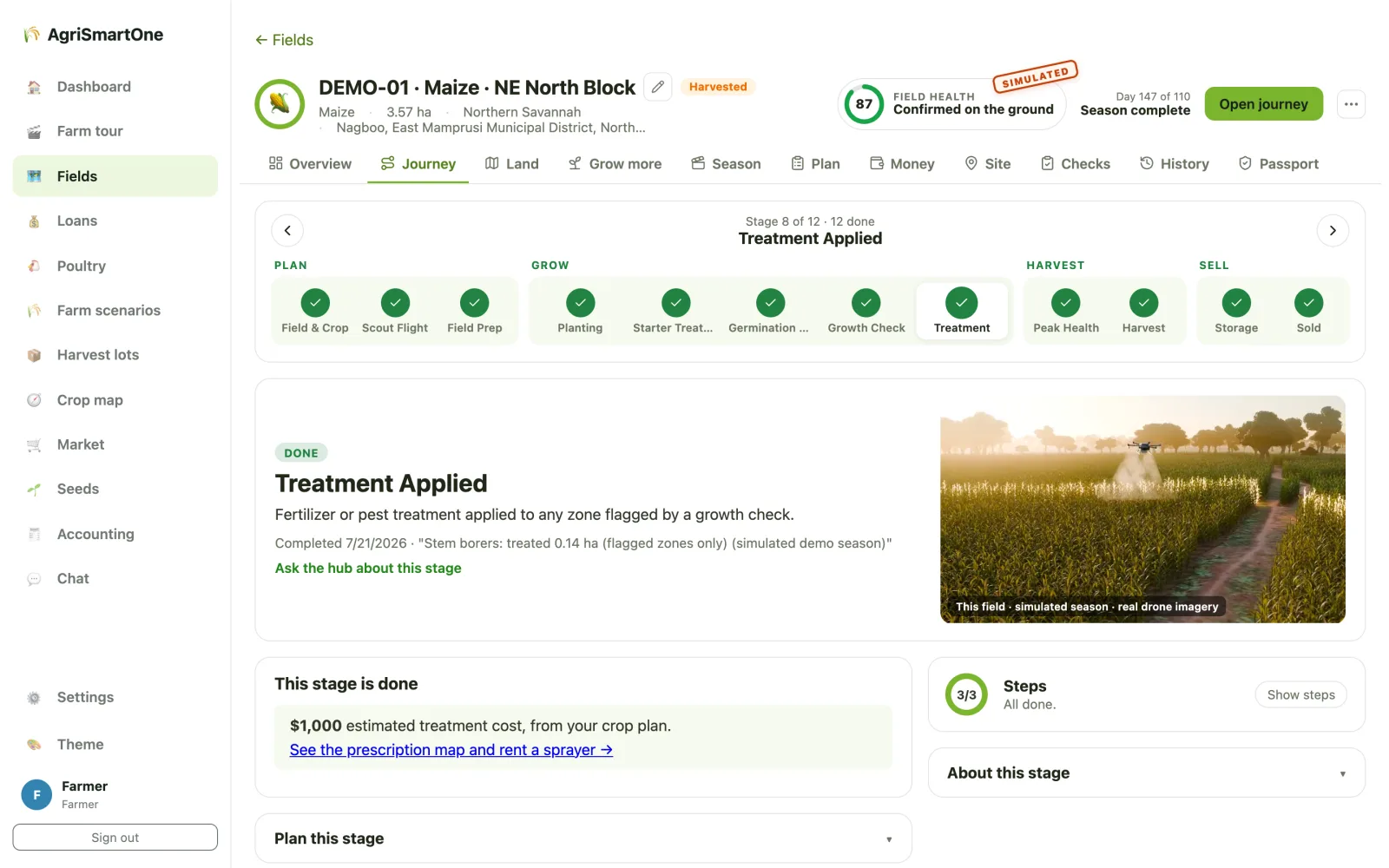
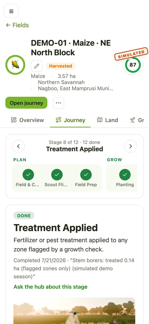
Each field has one home: a journey that knows what's done, what's next and when. Stages backed by real data complete themselves; the rest have a plain checklist.
- Choose the crop by what it earns in this zone
- Survey, plan, prepare, plant, scout, treat, harvest, store, sell
- Guidance in plain language at every stage
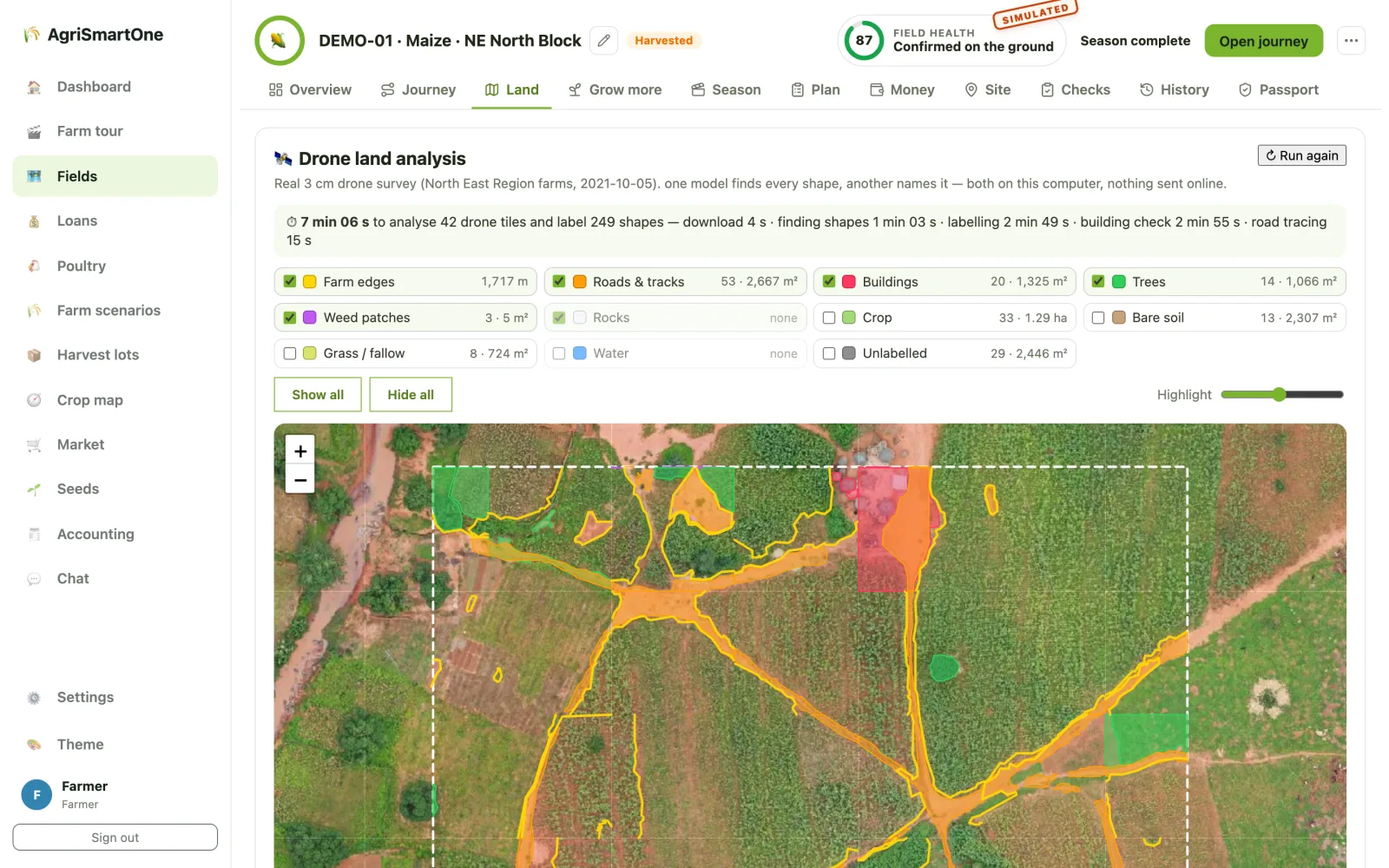
Every track, building, tree and weed patch, found by AI
From a 3 cm drone survey, the land analysis outlines farm edges, roads, buildings, trees, weeds and crop across every tile of the field, with counts and areas, on the hub's own computer.
- Show or hide each class, measured in m² and hectares
- "Grow more on the same land": price clearing stones, thickets and tracks
- A track plan that gives land back to crops without cutting anyone off
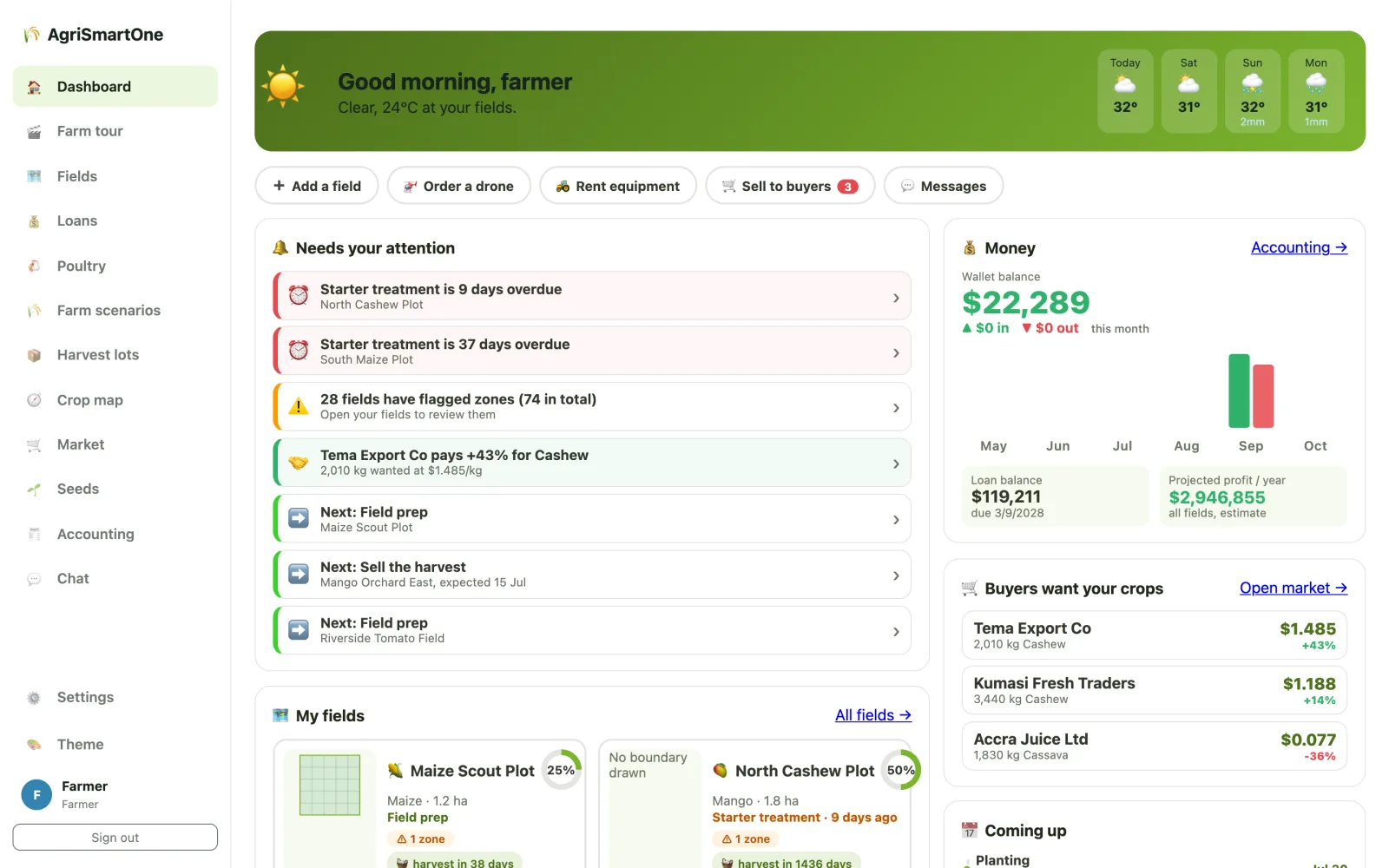
What needs attention, what it's worth, who's buying
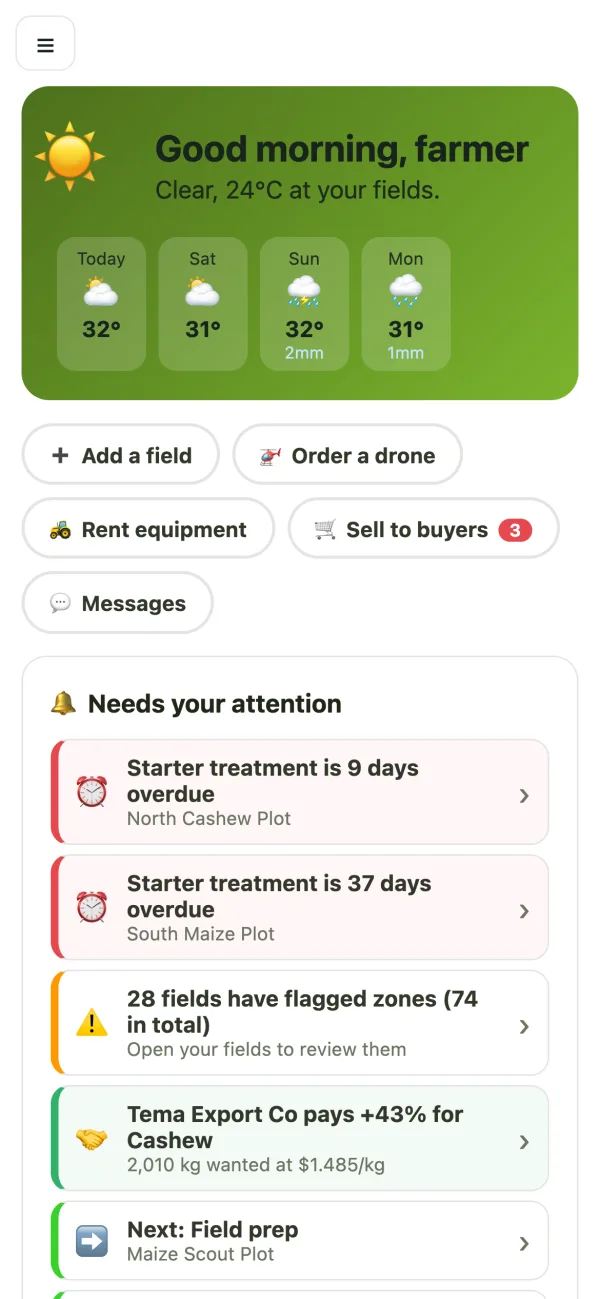
The farmer's home shows the weather, overdue tasks, flagged zones, wallet balance, profit projections and the buyers asking for her crops.
- Weather-aware advice ("hold off spraying until it passes")
- Money from an immutable ledger, never a number someone typed
- Buyers' offers next to the local price
Sell to the best bid, borrow from neighbours
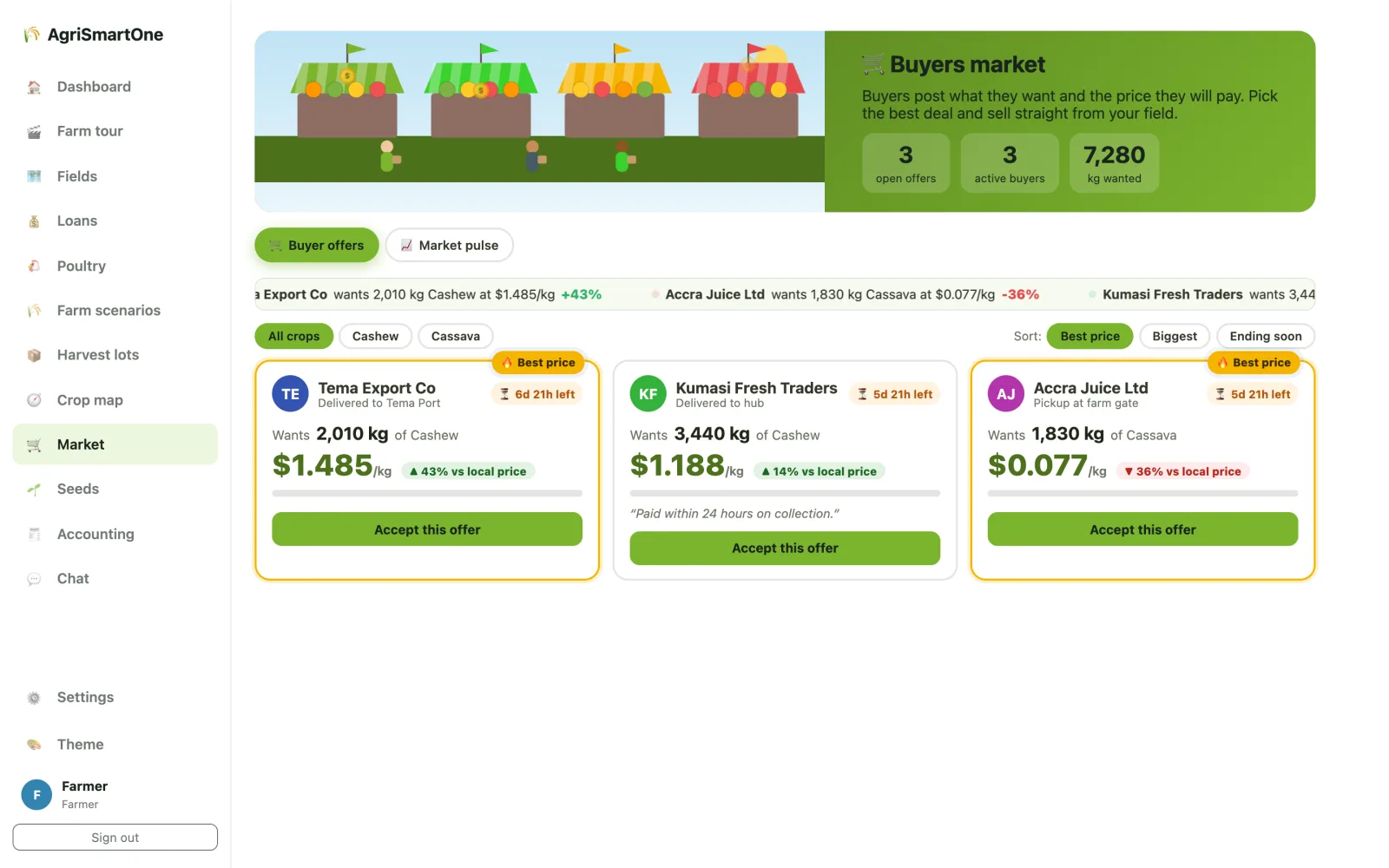
Buyers post what they want and what they'll pay; farmers accept the best offer. Loans are funded peer to peer with the hub's pool, and repaid automatically from the harvest sale.
- Buyer offers and auctions with mobile-money settlement
- Sell-ahead forward and option contracts
- Crop failure handled without punishing the farmer
One hub runs drones, labs and loans for a district
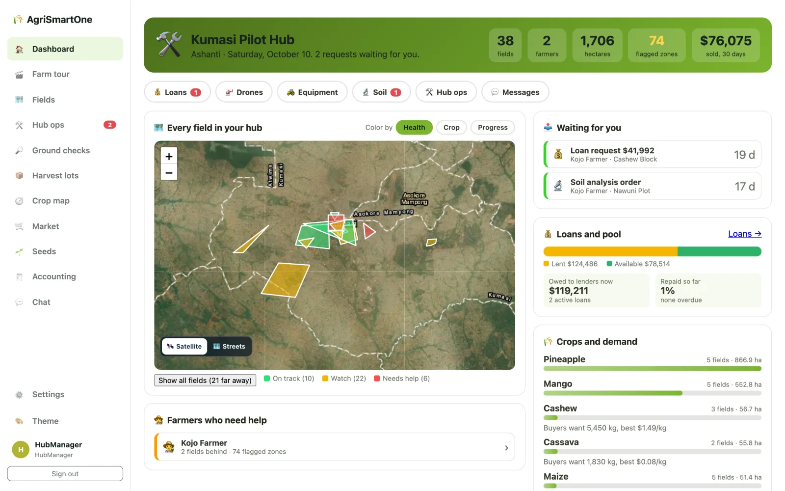
Hub staff see every field on the map, approve drone flights, soil tests and loans, and know which farmers need help today.
- Every dispatch approved by the hub, charged at approval
- Crops and demand across the hub's farms
- Satellite health for every field, every day
Sixteen farms, three lenses: investor, government, farmer
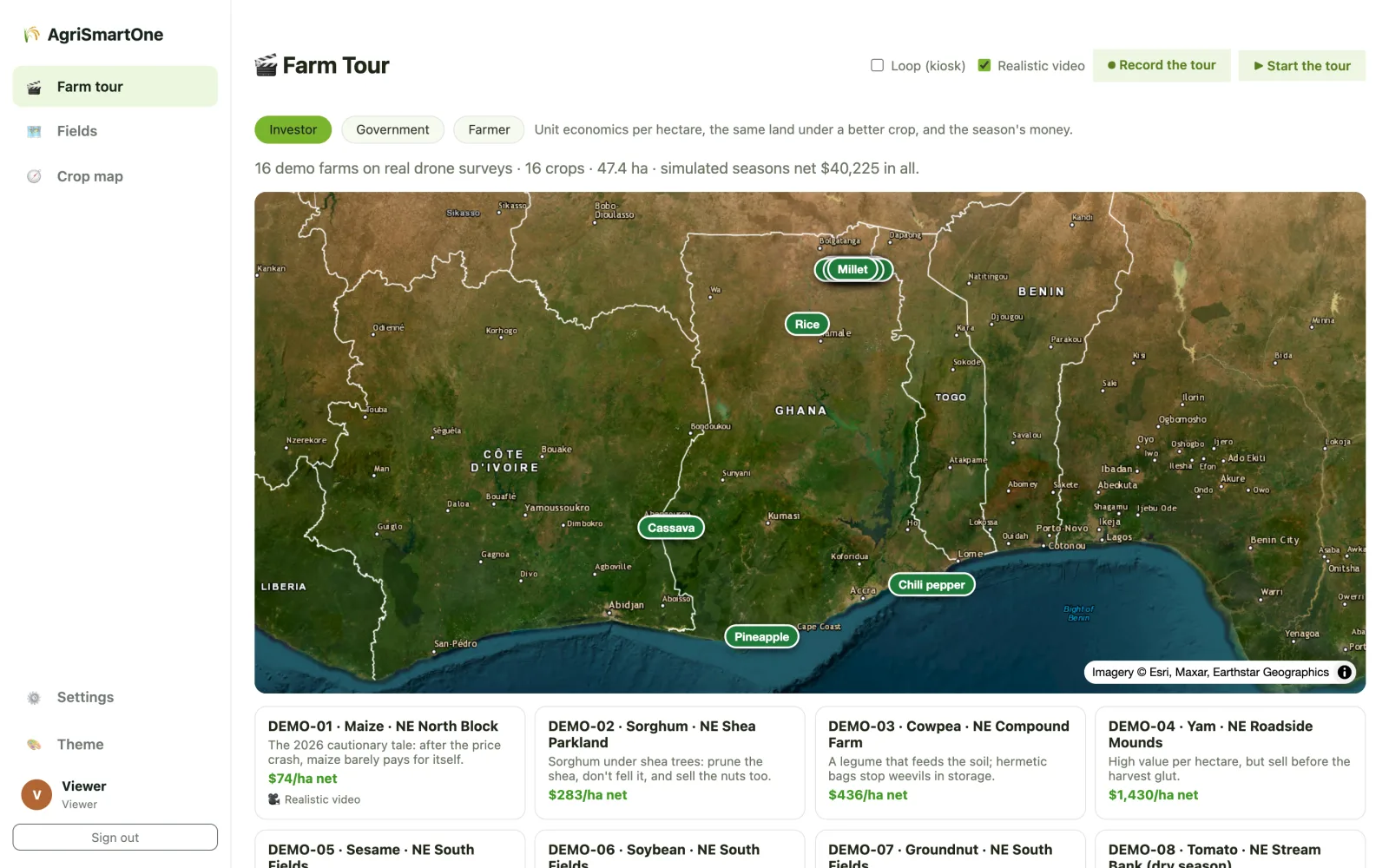
A read-only tour plays every demo farm's simulated season over its real drone survey, with the numbers each audience cares about.
- Read-only logins for investors and government
- Realistic season videos where they've been rendered
- A kiosk loop for demos and events
A field's whole story, that anyone can check
Lenders, buyers and inspectors ask the same questions: what has this field grown, how is it doing, and can I believe the records? AgriSmartOne answers each one from satellite data, the field's own history and records nobody can quietly change.
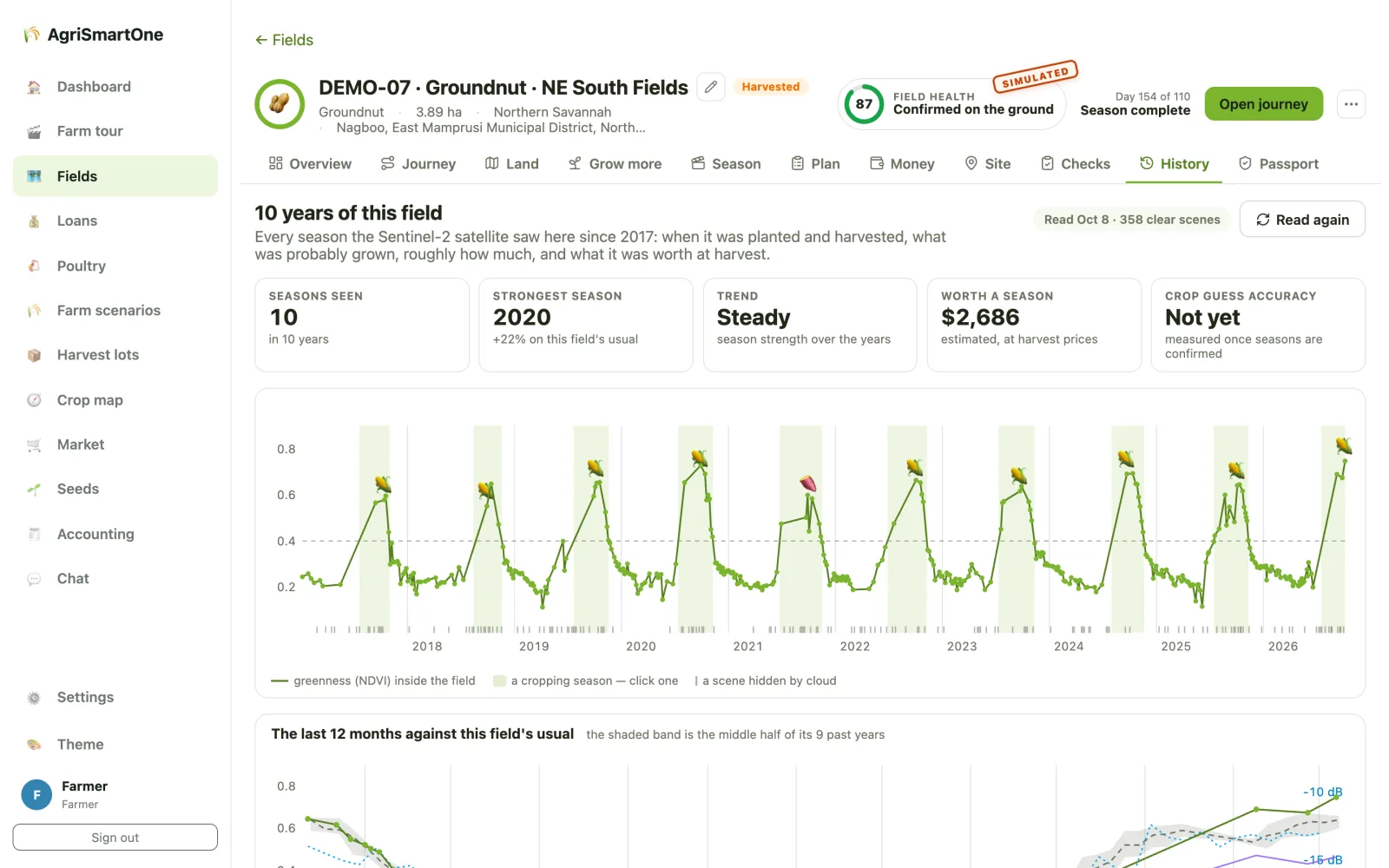
Ten years of every field, from satellite
Every season the Sentinel-2 satellite saw on the field since 2017: when it greened up, peaked and was harvested, how strong it was against the field's usual, what was probably grown and roughly what it was worth.
- Radar fills in the cloudy months that cameras can't see
- An alert when the field falls well below its own usual for the time of year
- Crop guesses stay labelled as guesses until the farmer or hub confirms them
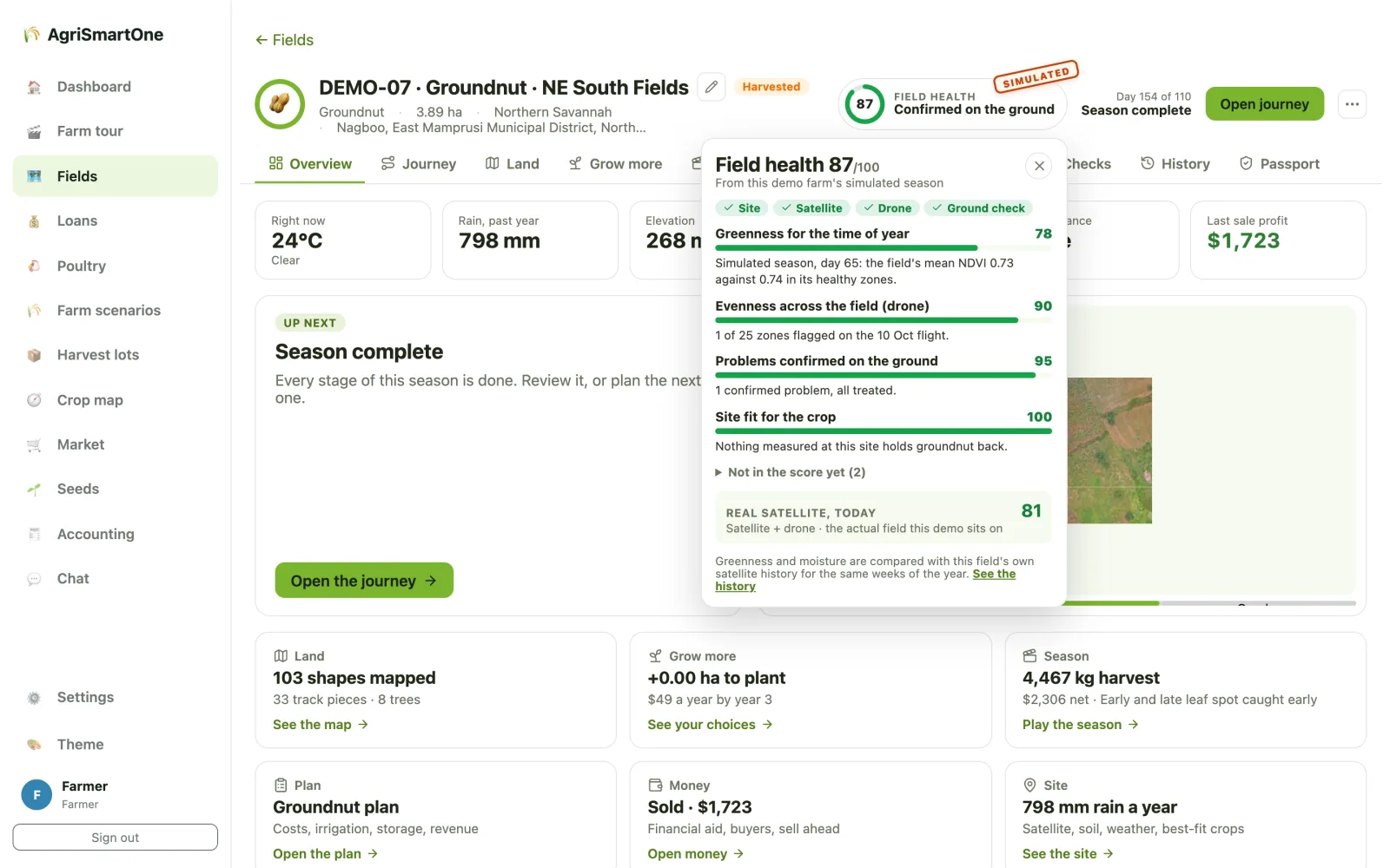
One number a lender can read, and open up
A score out of 100 built from parts anyone can see: greenness against the field's own past years, evenness from the drone, problems confirmed on the ground, and how well the crop suits the site.
- Missing parts are left out, never scored low
- The grade says what it rests on: site only, satellite, satellite + drone, or confirmed on the ground
- Kept week by week, so a lender sees the trend, not one day
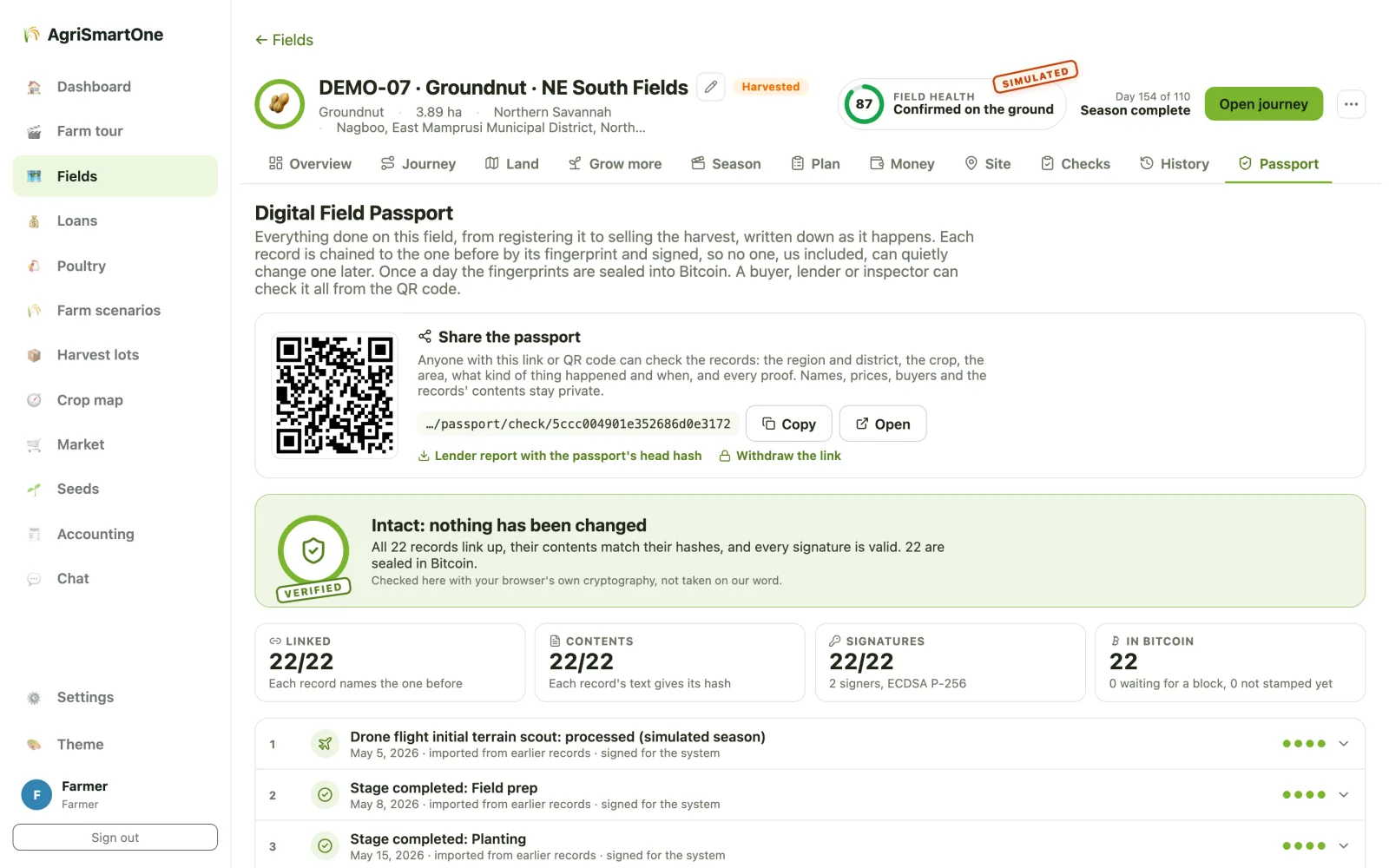
Records no one can quietly change, us included
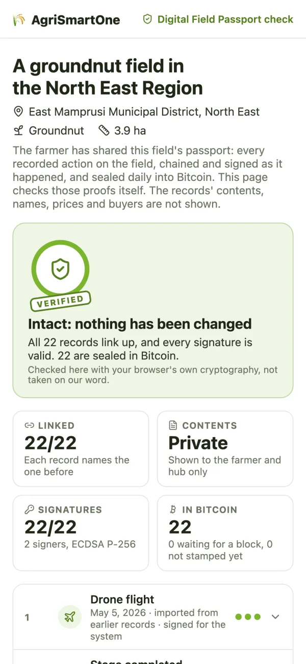
Everything done on the field is written down as it happens. Each record is chained to the one before it and signed, and once a day the day's fingerprint is sealed into Bitcoin through public timestamp services. A buyer, lender or inspector scans the QR code, and the check page tests every proof in their own browser.
- A correction is a new record; old ones are never edited
- The public page shows region, crop, area and the proofs, never names, prices or buyers
- In the prototype the platform's server holds each person's signing key; in the pilot it moves to their phone
Four gates before a lot ships
The harvest is packed into lots that carry the passport with them. A lot is ready only when all four gates pass for the market it is going to. No border accepts a private record as a certificate, so the passport holds the evidence, pre-fills the official papers and links each one to the issuer's own check.
Field
The passport is intact and the field meets the market's rules, including a plot map for the EU's deforestation check.
Grade
The lot is graded at the packhouse against the market's standard, and the result is recorded in the passport.
Lab
Samples go to an accredited lab for residues and toxins, and the result is recorded against the lot.
Inspector
The official phytosanitary inspection, recorded with its certificate. Then the export dossier and the pack's QR code are ready.
A whole maize season, from orbit to payment
A satellite scan flags a hot zone, a drone maps one farm, and the film follows its season: terrain, irrigation, zone-by-zone scouting, a zone-only spray, harvest, hub storage, the auction and the mobile-money payment.
Films, clips of the real app and animations, with playlists for farmers, hubs, government, buyers and lenders.
Farm data stays on the farm's own hub
The AI that reads drone imagery and labels the land runs on computers in the hub, not in a foreign cloud. If the internet drops, the hub keeps working.
- On-site inferenceSegmentation and labelling models run on the hub's hardware.
- Never blocked by connectivityField work and analysis carry on offline and sync later.
- Disclosed, alwaysAnything simulated is labelled; any outside service is listed in a register.
Hubs that pay for themselves, farmers who earn more
How it earns
- Drone services: survey and spray, per hectare
- Software subscriptions for farmers, hubs and buyers
- Soil and IoT testing
- Export aggregation and a small platform fee
Investor value
Hub hardware is planned to pay back in about 22 months, with a national roll-out district by district. A planning estimate, not a forecast.
Impact
Empowering farmers, raising yields on the same land, and strengthening Ghana's agricultural economy, with the data kept in Ghana.
Bring AgriSmartOne to your district
We're setting up the first pilot hubs with farmer groups, ministries, lenders and buyers. Tell us where you farm, lend or buy, and we'll show you the platform on your own land.